Two
grass pictures in the Netherlands on May 19, 2015 point to images of
“volcanos” in the landscape: do these field pictures describe just
an already-erupting volcano in Chile, or something more? (Field
image 1 from Hoeven Nature Preserve)
Two
grass pictures appeared in widely different locations, near Hoeven
in the Netherlands, on the morning of May 19, 2015. Such a
“duplication of effort” might suggest that these field images
express a very important message, which the crop artists wish us to
clearly understand?
When I
looked on Google Earth to see where their first grass picture had
been drawn (in Hoeven Nature Preserve), I saw immediately the
landscape image of an “exploding volcano”:
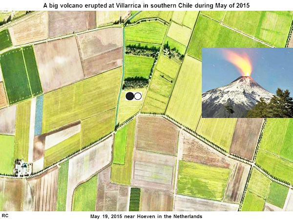
A big
volcano erupted at Villarrica in southern Chile in early May of 2015
(see
chile-volcano or
Apocalyptic-skies-return-Chile-second-volcano-erupts-entire-landscape-bathed-blood-red).
Perhaps their grass picture on May 19 describes such an important
event?
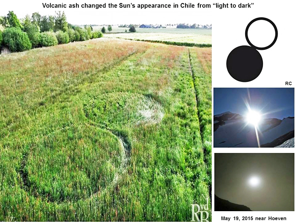
The sky
in southern Chile turned from “light to dark”, because it was
covered by volcanic ash:
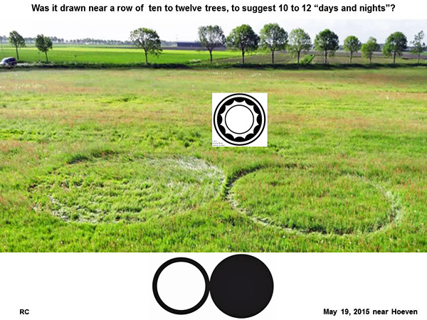
Was the
grass picture drawn next to a row of 10 to 12 trees, to suggest 10
to 12 “days and nights”?
When we
rotate this landscape image by 90o, we can see a the
“head of a man”, who is “looking at something” on the left (as
indicated by a dashed white line):
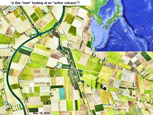
The new
grass picture (with its two circles) is located exactly where this
“man’s head” would contain “two nostrils”. Also the landscape “man”
seems to be “sneezing violently”, just as a volcano might eject hot
magma. What a humorous and successful metaphor!
Within
the two streams of ejected material from his “two nostrils”, we can
see the number “11”. Several capital letters inside of his “head”
suggest either time “T” or love “L”.
At first
one might regard this “man’s head” as a fortuitous and unintended
feature of the landscape nearby. Yet there was another “head of a
man” present in an entirely different location, close to two grass
pictures near Hoeven on April 28 or May 7. He was also “looking” at
something (in that case a “large wave”). Therefore, we believe that
this humorous landscape image may have been intended by the crop
artists, as way to help convey their intended message.
So what
is our friend “looking at”? If we follow that white dashed line from
his “eye” to a “bright square dot” on the left, we can see that the
entire picture matches some continental rift valleys under the ocean
south of Japan. Perhaps the crop artists are trying to show us a
“map of Earth’s surface”, by using landscape symbols near a local
field picture?
We have
seen similar strategies carried out in the past, by the crop artists
in England. When we follow their “instructions”, and look to see
where that “bright square dot” might reside precisely on Earth’s
surface, we find a very active “volcanic island” in the ocean, just
south of Japan:
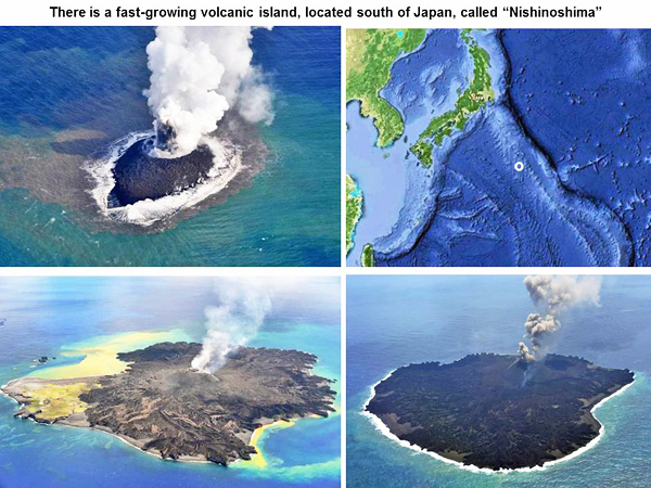
This
island is called “Nishinoshima”. It has risen out of the sea fairly
recently (see
nishinoshima). The three photographs shown were taken in 2013,
2014 or 2015 respectively.
Will
this oceanic volcano explode next, after the land-based volcano in
Chile? No one knows! If we look very closely at that “bright square
dot” on Google Earth, we can see the image of a “tropical island”.
This would be consistent with the near-tropical location of
Nishinoshima as a “refuge for bird life”.
The
interested reader may wish to follow this ongoing discussion
further, in Comments to grass picture number two, which appeared on
May 19, 2015 near Seppe Airport (see
Seppe Airport).
Red
Collie
(Dr. Horace Drew)