|
Image
Ademar Jose Gevaerd
Copyright 2018
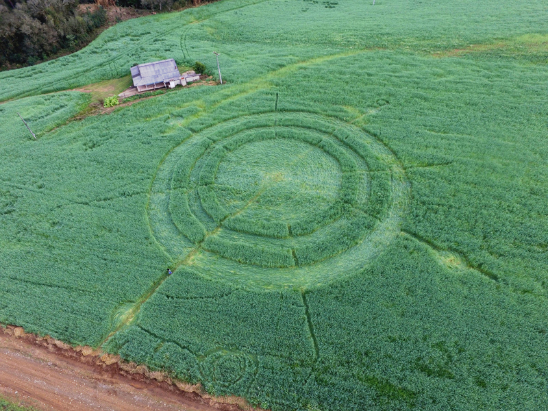
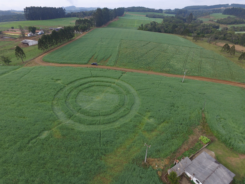
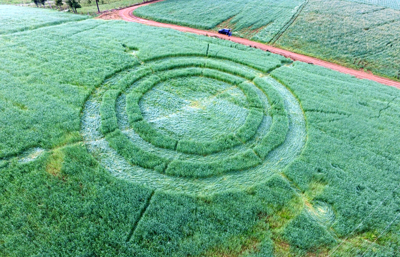
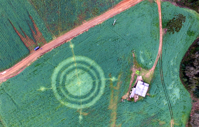
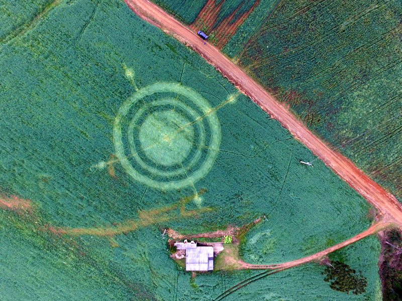
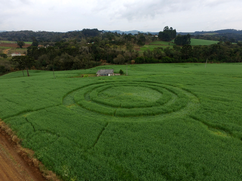
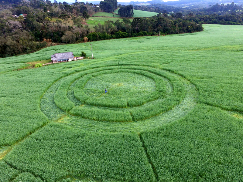
Two
aerial drone photographs of a new crop picture which appeared near the
small farming village of Jesuino Marcondes (20 km south of Prudentopolis)
in Brazil, silently on the night of August 2-3, 2018 next to an isolated
farmhouse.
Many
thanks to Ademar Jose Gevaerd and his research team for travelling there
and documenting the event! This crop picture was several days old after
many days of heavy rain, when the aerial photos were taken on August 5,
which may explain in part their rough appearance.
Some
brief notes on what this new Brazilian crop picture might be suggesting
to us?
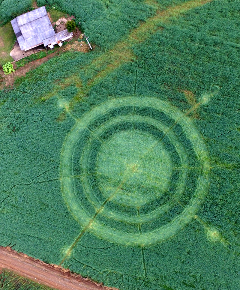
Four
short �arms� of this crop picture, which were drawn just outside of its
two large �rings�, are oriented approximately North, East, South or West
in the local landscape, thereby giving the overall impression of a
�navigational compass� which is moving from left to right, or
equivalently from East to West, as may been seen in a direct overhead
view.
There
is also the clear and striking image of a �bearded man� in the
landscape, as may been seen using Google Earth with a North-Northwest
compass reading of 340o �up�, who seems to be �walking� in
the same East-to-West direction. A thin horizontal line which was drawn
though the centre of this crop picture (from left to right) points
directly toward his figurative �head� (slides soon). The other thin
curved line (along the North-South axis of a �compass�) many be meant to
suggest some kind of East-to-West motion, rather than alternatively an
error in construction.
Red
Collie
(Dr. Horace Drew) |